
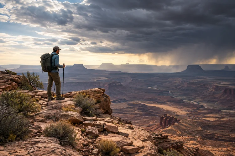
A quiet mountain valley, remote forest, desert plateau, or isolated coastline can look peaceful on a map.
Once you are actually there, however, a small problem such as a wrong turn, sudden storm, damaged water filter, or minor injury can become much more serious simply because help is far away.
Learning how to assess risk before entering isolated natural environments is therefore one of the most valuable outdoor skills you can develop.
Good risk assessment is not about assuming that everything is dangerous. It is about understanding what could realistically go wrong, how likely those problems are, and how difficult they would be to manage in that particular location.
The National Park Service recommends researching local hazards, matching trips to the abilities of everyone involved, and preparing for emergencies before entering backcountry areas.
By combining terrain analysis, weather awareness, communication planning, personal capability, and clear decision thresholds, you can make remote travel considerably safer without removing the sense of adventure.
1. Start by Identifying the Hazards Specific to the Area
Risk assessment begins with a simple question: What can actually hurt you here?
The answer changes dramatically between environments. In a desert, dehydration, heat exposure, flash flooding, and long distances between water sources may dominate the risk profile.
In alpine terrain, thunderstorms, snowfields, steep slopes, altitude, rockfall, or rapid temperature changes may be more important.
Remote wilderness can also change over time. The National Park Service notes that landscapes may be altered by flooding, landslides, retreating glaciers, river movement, and other natural processes, meaning older maps or guidebooks should not always be treated as completely accurate.
Before leaving, check current information from land managers, weather agencies, recent trail reports, maps, and local authorities. Your assesment should be based on present conditions rather than what somebody experienced several years ago.
2. Evaluate Terrain Beyond Distance Alone
A 15-kilometer route does not always represent the same level of difficulty.
Fifteen kilometers along a maintained valley trail could be relatively straightforward, while the same distance through thick vegetation, scree, swamp, snow, or steep off-trail terrain might require most of a day.
Study topographic maps for elevation gain, slope angle, river crossings, exposed ridges, cliffs, narrow valleys, and possible escape routes. Consider whether bad weather could make any of those features substantially more dangerous.
One National Park Service backcountry planning guide for Grand Teton, for example, suggests estimating travel at no more than two miles per hour and adding additional time for major elevation gain.
That recommendation is location-specific, but it illustrates an important point: wilderness travel times should generally be conservative rather than optimistic.
Build extra time into the route instead of assuming you will maintain your normal walking pace all day.
3. Treat Weather as a Risk Multiplier
Weather rarely creates only one problem.
Heavy rain can lower visibility, increase hypothermia risk, raise river levels, make rocks slippery, damage roads, and turn normally harmless channels into dangerous flood routes. Strong wind may make exposed ridges difficult to cross while also increasing the impact of cold temperatures.
Before entering remote terrain, check both the general forecast and hazards that are particularly relevant to the landscape.
The National Weather Service warns that flooding can occur downstream even when rain is not falling directly where you are standing. People camping or hiking near waterways should therefore consider upstream weather as well as local conditions.
Thunderstorms require similar caution. The NWS notes that there is no completely safe outdoor location when lightning is nearby and recommends planning mountain travel so exposed terrain can be cleared before storms develop.
Weather should influence whether you go, where you travel, and when you turn around.
4. Assess the Consequences of Navigation Failure
Getting slightly lost in a popular park with marked trails and phone coverage may cost you an inconvenient hour.
Getting lost several days from the nearest road can become an emergency.
Ask what would happen if your primary navigation method stopped working. A smartphone could run out of battery, become wet, suffer screen damage, or lose functionality in extreme cold.
Remote travel is safer when navigation has several layers. Offline digital mapping may be combined with a physical topographic map, compass, GPS unit, or other suitable backup depending on the environment.
Leave No Trace specifically recommends gaining knowledge of an area before travelling and using appropriate navigation tools such as maps and compasses when planning backcountry activities.
More importantly, understand the landscape itself. Major rivers, ridgelines, valleys, coastlines, and peaks can serve as large-scale navigation references even when electronics fail.
5. Examine Water, Food, and Exposure Risks
Water deserves special attention because assumptions about availability can be dangerously misleading.
A stream shown on a map could be seasonal. A water source might be frozen, contaminated, difficult to reach, or dry after an unusually warm period. In other places, abundant water may still be unsafe to drink.
The CDC advises treating wilderness water when its safety is uncertain. Even clear mountain water can contain microorganisms capable of causing illness, while boiling is considered the most reliable method for killing germs.
Filtering followed by disinfection is another strong approach.
Estimate the distance between dependable sources and determine how much water you can realistically carry.
Food and environmental exposure should be evaluated in the same way. Ask whether an unexpected overnight delay would leave you without enough energy, insulation, shelter, or cooking fuel.
Your supplies should give you a safety margin rather than matching the planned itinerary perfectly.
6. Consider the Abilities of the Entire Group
A route may be reasonable for one experienced wilderness traveler but inappropriate for a group containing beginners.
Fitness is only one part of that equation. Navigation ability, swimming skills, confidence around heights, cold tolerance, technical experience, medical considerations, and decision-making under stress can all influence overall risk.
The National Park Service recommends choosing routes according to the abilities and weaknesses of the entire party rather than simply following the strongest participant.
Talk about limitations before leaving. Someone who is uncomfortable crossing fast-moving water, for example, should say so during preperation rather than when the group is already committed to a remote river valley.
Also consider how fatigue may change behavior. People often make poorer decisions after long periods of physical exertion, hunger, cold, or sleep deprivation.
7. Measure Isolation by Access to Help
One useful way to think about wilderness risk is to separate hazard severity from rescue difficulty.
A minor ankle injury beside a road is usually manageable. The same injury deep inside an isolated canyon could prevent someone from walking for days.
Before entering a remote location, ask how rescuers could realistically reach you. Consider distance from roads, helicopter access, tree cover, canyon terrain, river barriers, local rescue capability, and communication coverage.
A detailed trip plan should also be left with a responsible person. The National Park Service recommends including information such as who is traveling, the planned route, transportation details, anticipated return times, alternate itineraries, and relevant emergency information.
Do not merely say, “I should be back this weekend.” Establish exactly when an overdue traveler should trigger concern and what the contact person should do.
Satellite communicators or personal locator beacons may provide another layer of protection, but they should not be viewed as a substitute for self-reliance.
8. Establish Turnaround Points Before Problems Appear
One of the hardest wilderness decisions is turning back after investing hours or days into an objective.
That is why decision thresholds should ideally be established before emotions become involved.
You might decide that you will turn around if a river exceeds a certain level, if visibility drops below a usable range, if the group reaches a particular location later than expected, or if thunderstorms begin developing before an exposed crossing.
These rules prevent what is sometimes called “summit fever” – continuing simply because the destination feels close.
The National Park Service advises travelers not to continue with original plans when environmental hazards, weather, health concerns, or site conditions make those plans unsafe.
Changing a route is not a failed trip. In isolated environments, adapting early is often evidence that your risk management is working.
9. Think About Environmental Impact as Part of Safety
Human impact and personal safety are more connected than they first appear.
Poorly planned camps can contaminate water, attract wildlife, damage fragile vegetation, and create fire hazards. Travelers who become lost may also create unnecessary trails, markers, or disturbed campsites while trying to recover their route.
Leave No Trace recommends researching regulations, preparing for hazards and extreme weather, travelling in appropriately sized groups, minimizing waste, and planning routes carefully before departure.
Responsible travel therefore starts long before entering the wilderness.
Know whether permits are required, understand food-storage rules, check fire restrictions, and learn how waste should be managed. These details may seem minor compared with navigation or weather, but ignoring them can quickly create additional problems in an already remote enviroment.
Assessing wilderness risk is not about trying to predict every possible accident. The goal is to identify the most realistic hazards, understand their consequences, and build enough flexibility into your plan to respond intelligently.
Evaluate terrain, current weather, navigation difficulty, water availability, environmental exposure, group capability, and access to rescue before committing to an isolated route. Then establish clear alternatives and turnaround points.
Most importantly, be willing to change your plans when conditions change. Remote places will always contain uncertainty, and that is part of their appeal.
Prepare carefully, verify current local conditions, leave a detailed trip plan, and make conservative decisions when the consequences of a mistake would be difficult to reverse.