
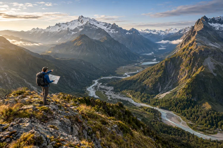
A route can look perfectly reasonable on a screen and become completely different once you step into the landscape.
A narrow valley may hide difficult river crossings, a gentle-looking ridge may contain exposed slopes, and a shortcut between two trails can become an exhausting maze of cliffs and dense vegetation.
This is why understanding how terrain analysis improves safety on remote nature expeditions is such an important outdoor skill.
Terrain analysis means studying the physical shape of the landscape before and during a journey so you can predict obstacles, identify safer travel corridors, estimate effort, and recognize places where small problems could become serious.
Topographic maps are particularly useful because contour lines show the shape and elevation of the land, while additional map features can reveal rivers, valleys, vegetation, roads, and other useful landmarks.
Instead of simply asking, “Can we get from here to there?”, experienced travelers ask a better question: “What will the terrain require from us along the way?”
1. Read Contour Lines as a Picture of the Landscape
Contour lines are one of the foundations of terrain analysis.
Each line connects points at the same elevation. When the lines are widely spaced, the slope is generally gentler. When they are packed closely together, the terrain becomes steeper.
Once you become comfortable reading them, a flat map begins to look almost three-dimensional. You can identify valleys, ridges, saddles, peaks, depressions, and steep faces before arriving.
The U.S. Geological Survey explains that topographic maps use contour lines specifically to represent the shape and elevation of terrain on a two-dimensional surface.
This information is valuable when choosing a safer route. A direct line toward a destination may cross several steep slopes, while a slightly longer route along a valley or broad ridge could require less technical movement and considerably less energy.
Good route assesment therefore considers both distance and vertical shape.
2. Use Slope Analysis to Predict Difficulty
Not every slope is dangerous, but steepness changes almost every part of wilderness travel.
Climbing steep ground increases physical effort, while descending can place more stress on knees and ankles. Loose rock, snow, mud, or wet vegetation can make the same slope significantly more difficult.
Before committing to a remote route, examine how quickly elevation changes. Closely spaced contours may indicate sections where travel becomes slow or where a simple fall could have greater consequences.
Slope direction also matters. A shaded slope may hold snow longer, while a sun-exposed hillside may become hotter and drier. In some environments, different slope aspects can even affect vegetation density and water availability.
Terrain analysis helps you identify where slower travel is likely before building a daily schedule.
This is especially important on multi-day trips. If several steep climbs appear close together, planning an aggressive mileage target can create fatigue that affects decision-making later.
3. Study Valleys and Drainage Before Following Them
Valleys often look attractive because they provide natural travel corridors. However, they can also concentrate water, vegetation, rockfall, and flood hazards.
Pay close attention to rivers, creeks, gullies, and drainage channels. A dry streambed is not automatically a safe campsite or convenient walking route.
The National Weather Service warns that flash flooding can develop rapidly and that dry channels can become dangerous torrents even when rain is not falling directly overhead. It also notes that relatively shallow fast-moving water can knock a person off their feet.
Look beyond the immediate location. Ask where water from surrounding mountains would naturally travel during heavy rain.
Narrow canyons deserve particular caution because they may offer few escape options. A wider valley with access to higher ground generally provides more flexibility.
Understanding drainage lets you see the landscape not only as it looks now, but also as it could behave during changing weather.
4. Identify Exposed Terrain Before Weather Arrives
Ridges and summits can provide efficient travel and excellent visibility, but they also increase exposure.
Strong winds, cold temperatures, thunderstorms, and lightning may become more serious above treeline or on isolated high points.
The National Weather Service states that no outdoor location is completely safe during a thunderstorm and advises backcountry travelers to plan mountain travel so they can leave exposed terrain before storms develop.
Terrain analysis allows you to identify these exposed zones beforehand.
If a route includes a long ridge crossing, for example, you can plan to reach it earlier in the day, establish a turnaround time, and identify lower terrain that could serve as an alternative.
That is much better than discovering halfway across the ridge that dark clouds are developing and the nearest protected area is several hours away.
The landscape itself becomes part of your weather strategy.
5. Use Terrain Features to Strengthen Navigation
Navigation becomes safer when you understand the landscape around the route rather than relying only on a GPS track.
Large physical features such as rivers, lakes, ridges, valleys, and mountain passes can act as natural navigation references.
Suppose your route should remain west of a major river and eventually cross a saddle between two peaks. Even if your electronic device stops working, those features can help you understand your general location.
USGS guidance notes that topographic maps can show landforms, waterways, distance, and direction, making them valuable for both route planning and navigation.
Remote areas make this redundancy especially important. Gates of the Arctic National Park, for example, describes topographic maps as essential for planning travel and recommends carrying a compass, with GPS providing another useful layer.
Technology is useful, but terrain awareness means you are not following a digital line seperately from the real landscape.
6. Locate Natural Escape and Bailout Routes
A strong expedition plan includes places where the original route can be changed.
Terrain analysis helps identify valleys leading toward roads, lower passes, connecting trails, navigable rivers, ranger facilities, or other potential exit points.
These alternatives become important when someone is injured, equipment fails, weather deteriorates, or the group falls behind schedule.
A bailout route should not simply exist on the map. You need to assess whether it is actually realistic.
A valley that appears to lead directly toward civilization may contain cliffs, dense brush, deep river crossings, or private land. A lower mountain pass might still be covered by dangerous snow.
The U.S. Forest Service recommends studying maps, learning the terrain, and becoming familiar with alternate routes and weather before beginning a trip.
Marking several realistic escape options during preperation can prevent a difficult situation from becoming a full emergency.
7. Estimate Travel Speed From Terrain Complexity
Distance alone is a poor predictor of travel time in wilderness environments.
Five kilometers along a clear trail may be easy. Five kilometers through boulder fields, thick vegetation, steep gullies, or repeated creek crossings can consume several hours.
Terrain analysis improves scheduling because it allows you to divide a route into different difficulty zones.
Easy valley walking might allow faster progress. Steep climbs, complicated navigation, or loose surfaces should receive much more time.
Shenandoah National Park advises backcountry travelers to consider both mileage and elevation gain, particularly when hiking steep mountain terrain with loaded packs.
Add generous margins when travelling away from maintained trails.
You should also consider cumulative fatigue. A technically simple section on day four may feel much harder after three demanding days.
This is why experienced expedition planners often prefer conservative estimates rather than schedules that depend on perfect conditions.
8. Recognize That Terrain Can Change
Maps are incredibly useful, but they are snapshots of a landscape.
Remote environments can change through floods, landslides, erosion, glacial movement, wildfires, storms, and shifting rivers.
Wrangell–St. Elias National Park warns visitors that glaciers retreat, landslides rearrange mountainsides, and rivers flood, so older guidebooks and other outside resources should not always be assumed to reflect current conditions.
That means terrain analysis should continue after the expedition begins.
Compare the map with what you actually see. If a river channel has moved, vegetation has become much denser, or a slope shows recent landslide activity, adjust your assumptions.
Remote travel becomes safer when maps guide your decisions without overriding obvious real-world evidence.
Flexible thinking is especially important in an enviroment where rescue access may be slow or difficult.
9. Combine Terrain Analysis With Group Capability
A route does not have a single fixed difficulty level.
The same terrain may be reasonable for an experienced group and inappropriate for beginners carrying heavy packs.
Consider how each landscape feature interacts with the group’s skills. Steep snow may require techniques that everyone does not possess. Scrambling terrain may become challenging for someone uncomfortable with exposure. Frequent river crossings could create problems for a traveler with limited balance.
Shenandoah National Park recommends planning backpacking trips around the least-fit member of the group and considering the skills needed for terrain, navigation, and camping.
Good terrain analysis is therefore partly human analysis.
Instead of asking whether a route is theoretically possible, ask whether your particular group can travel through it safely while carrying expedition equipment and handling unexpected conditions.
10. Use Terrain Analysis to Reduce Environmental Impact
Reading the landscape also helps protect the places you travel through.
Planning ahead can reduce unnecessary trail creation, damaged vegetation, poor campsite choices, and excessive disturbance in fragile areas.
Leave No Trace recommends researching hazards and regulations, preparing for extreme weather, and using maps and compasses as part of responsible trip planning.
For example, understanding where durable surfaces, established routes, and appropriate camping areas are located can help prevent travelers from wandering repeatedly through sensitive vegetation.
Terrain knowledge can also reduce the need to build cairns, mark trees, or create improvised navigation signs.
In that sense, knowing the land improves both personal safety and environmental responsibility.
Terrain analysis turns a wilderness map from a simple route display into a powerful safety tool. By studying contour lines, slopes, drainage systems, ridges, escape routes, exposure, and natural navigation features, travelers can anticipate difficulties before physically reaching them.
Understanding how terrain analysis improves safety on remote nature expeditions also makes route schedules more realistic and helps groups adapt when weather or landscape conditions change.
Before your next remote journey, spend time reading the terrain rather than simply measuring distance.
Compare topographic information with current conditions, identify dangerous sections and backup routes, and match the route to your group’s actual abilities. The better you understand the shape of the landscape, the more informed – and safer – your decisions can become.