
Planning a one-day hike is relatively simple. You choose a trail, check the weather, pack enough food and water, and try to return before dark. A multi-day wilderness journey is different because every decision affects what happens several days later.
A difficult climb on day one can create fatigue on day two. A dry water source may force you to change campsites. One storm can turn an easy river crossing into a major obstacle. Even a minor navigation mistake can disrupt the entire itinerary.
That is why advanced route planning for multi-day wilderness travel adventures requires more than drawing a line between two points on a map.
Good planning combines terrain analysis, realistic daily distances, water availability, campsite options, weather, navigation, and contingency routes.
The National Park Service recommends considering trip duration, daily mileage, elevation gain, terrain, and the fitness and experience of everyone in the group before committing to a backcountry itinerary.
The goal is not to create a perfectly rigid schedule. It is to build a route flexible enough to survive real wilderness conditions.
1. Design the Route Around Terrain, Not Just Distance
Distance is usually the first number people notice when planning a wilderness route, but mileage alone says very little about difficulty.
Ten miles across gentle forest trails might feel comfortable. Ten miles involving steep climbs, loose scree, river crossings, thick vegetation, snowfields, or off-trail navigation could require an entire day.
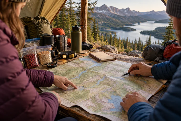
Start by studying a detailed topographic map. Look at contour spacing, major ridgelines, passes, valleys, drainage systems, cliffs, water crossings, and possible camping terrain.
Elevation deserves particular attention. Grand Teton National Park, for example, advises backpackers planning routes there to estimate no more than two miles per hour and add an extra hour for every 1,000 feet of elevation gained.
This is a location-specific guideline rather than a universal formula, but it demonstrates how significantly climbing can affect travel time.
Use conservative estimates, especially when the terrrain is unfamiliar.
2. Calculate Sustainable Daily Mileage
A common route-planning mistake is building every day around your maximum hiking capability.
Maybe you can comfortably hike 20 miles during a day trip. That does not automatically mean you should schedule 20 miles every day while carrying several days of food, shelter, cooking equipment, and extra clothing.
Multi-day travel creates cumulative fatigue. Feet become sore, pack straps irritate shoulders, sleep quality varies, and repeated elevation changes gradually reduce performance.
Shenandoah National Park recommends considering shorter mileage on the first day and identifying realistic distances for subsequent days while accounting for steep and rocky terrain.
It also recommends identifying several potential camping areas because locations that appear suitable on a map may not work in reality.
Build at least some easier days into longer itineraries. These give your body time to recover and create flexibility if earlier sections take longer than expected.
3. Plan Campsites Before You Need Them
A campsite is more than the place where the day ends.
Its location determines how far you walk, how much water you carry, when you cross difficult terrain, and how much daylight remains for cooking and shelter setup.
Before departure, identify a preferred camping area plus alternatives nearby. A seemingly perfect flat section on a map could turn out to be marshy, exposed to wind, covered in dense vegetation, or prohibited for camping.
Regulations matter too. Some wilderness areas restrict where visitors can camp or require permits for specific zones.
North Cascades National Park, for example, requires backcountry permits for overnight wilderness trips and recommends researching routes, campsites, regulations, and current conditions while planning.
Whenever possible, avoid designing an itinerary that depends on reaching one exact campsite.
Having several options makes the schedule much more adaptable.
4. Build the Route Around Reliable Water Sources
Water often determines the shape of a multi-day wilderness journey more than anything else.
A route with regular streams allows you to carry less weight. A dry ridgeline, desert section, or limestone landscape may require carrying several liters between dependable sources.
Never assume every blue line on a map will contain usable water. Seasonal streams can disappear, springs may dry during drought, and freezing temperatures can make water harder to access.
Before leaving, compare maps with recent ranger information, trail reports, seasonal conditions, and local knowledge whenever possible.
Water quality matters as much as availability. The CDC warns that even clear-looking wilderness water can contain disease-causing microorganisms and recommends treating water when its safety is uncertain.
Boiling is considered the most reliable method for killing germs, while filtering followed by disinfection is another strong option.
Plan backup sources and carry enough capacity to handle an unexpectedly dry section.
5. Create a Layered Navigation Strategy
Phone navigation is convenient, but your entire expedition should not depend on one battery-powered screen.
Use offline maps, but support them with other navigation methods appropriate to your destination. That could include a GPS unit, physical topographic map, compass, route notes, or coordinates for key locations.
The U.S. Forest Service advises wilderness travelers using GPS to also carry a map and compass as backups in case electronic navigation fails.
Study the landscape before departure rather than simply downloading a route. Learn where the major valleys, rivers, ridges, lakes, passes, and roads sit in relation to your direction of travel.
Navigation checkpoints can also improve accuracy. Instead of thinking, “Follow this trail for nine miles,” divide the route into identifiable features such as a creek junction, saddle, lake, ridge, or trail intersection.
This makes it easier to notice mistakes early instead of discovering several hours later that you have travelled in the wrong direction.
6. Account for Weather Windows and Exposure
Weather should influence where you travel during different parts of the day.
An exposed ridge that is manageable during a calm morning could become dangerous during an afternoon thunderstorm. A river that is easy to cross before heavy rainfall may become impossible several hours later.
The National Weather Service recommends checking forecasts before outdoor trips and leaving elevated locations such as ridges and peaks when thunderstorms approach. It also emphasizes that no outdoor location is completely safe when lightning is nearby.
Study typical weather patterns before setting your daily schedule. In mountainous regions where afternoon storms are common, for example, you may want to cross exposed passes earlier.
Weather can also change expected pace. Rain makes rocks slippery, snow hides trails, wind increases effort, and extreme heat may require longer rest periods.
Treat weather as part of route design rather than something you check only during preperation.
7. Add Bailout Routes and Decision Points
A sophisticated wilderness itinerary includes ways to stop the trip safely.
Mark roads, ranger stations, trailheads, lower valleys, populated areas, alternate trails, or transportation points that could serve as bailout routes.
Then consider when you would actually use them.
Perhaps your group reaches a particular junction one day behind schedule. Maybe someone develops knee pain, an essential piece of equipment fails, or severe weather is forecast for the next mountain section.
Deciding in advance what conditions justify changing the itinerary can prevent emotional decision-making.
The National Park Service recommends including both main and alternate itineraries in detailed backcountry trip plans, along with known risks, potential delays, communication arrangements, and daily route details.
A backup route is not evidence that you expect failure. It is evidence that you understand wilderness conditions can change.
8. Use Time Buffers Instead of Perfect Schedules
Multi-day routes should have breathing room.
If every day requires perfect weather, flawless navigation, ideal trail conditions, and maximum hiking speed, the itinerary is probably too aggressive.
Add spare hours to daily plans and consider a contingency day during longer trips. You may never need it, but it can absorb delays caused by storms, swollen rivers, equipment repairs, unexpected route-finding, or fatigue.
This flexibility is especially important near the end of an expedition. Travelers sometimes schedule transportation immediately after the expected finish time, leaving no margin for delays.
Build enough time that arriving several hours – or even a day – later than the ideal schedule does not automatically create another problem.
Planning ahead also supports responsible wilderness use. Leave No Trace recommends preparing for hazards and extreme weather, knowing local regulations, using proper navigation, and planning carefully enough to minimize environmental impact.
Good schedules protect both travelers and the places they visit.
9. Leave a Detailed Route Plan With Someone Else
Even excellent navigation does not eliminate the possibility of an emergency.
Before starting a remote multi-day trip, give a detailed itinerary to someone who will remain outside the wilderness.
Include entry and exit points, planned camps, daily route segments, alternate routes, vehicle information, group details, communication methods, and your expected return time.
More importantly, establish exactly when that person should take action if you fail to check in.
The National Park Service notes that detailed trip plans can provide crucial information during search-and-rescue operations, particularly when they include main and alternate itineraries, scheduled check-ins, routes, risk factors, and expected return details.
Satellite communicators can strengthen this system where cellular networks are unavailable, but they do not replace thoughtful route planning.
Check your communication device occassionally during the expedition and conserve enough battery for unexpected delays.
10. Review the Entire Route as One Connected System
The final stage of route planning is looking at everything together.
Daily distance affects campsite selection. Campsites affect water requirements. Water availability changes pack weight. Pack weight influences speed. Speed determines whether you reach an exposed pass before bad weather arrives.
That connection is what separates advanced route planning from simply following a trail description.
Before departure, mentally travel through every day of the itinerary. Ask where you will get water, where you could camp early, what happens if conditions deteriorate, and where you could leave the route if necessary.
Also check current permits, closures, trail conditions, fire restrictions, wildlife regulations, and weather immediately before departure. Conditions can change even after months of careful planning.
Your final itinerary should therefore remain flexible rather than being treated as a contract.
Successful multi-day wilderness travel depends less on creating the longest possible route and more on designing one you can adapt when reality differs from the map.
Effective advanced route planning for multi-day wilderness travel adventures considers terrain, elevation, sustainable mileage, campsites, water availability, navigation backups, weather exposure, bailout routes, and emergency communication as parts of one connected system.
Build conservative daily targets, identify multiple camping and water options, and leave enough time for unexpected delays. Most importantly, be willing to modify the itinerary when conditions demand it.
Before your next wilderness adventure, spend more time studying the route than simply calculating its distance. A flexible, well-researched plan gives you more freedom to enjoy remote landscapes while keeping avoidable risks under control.