
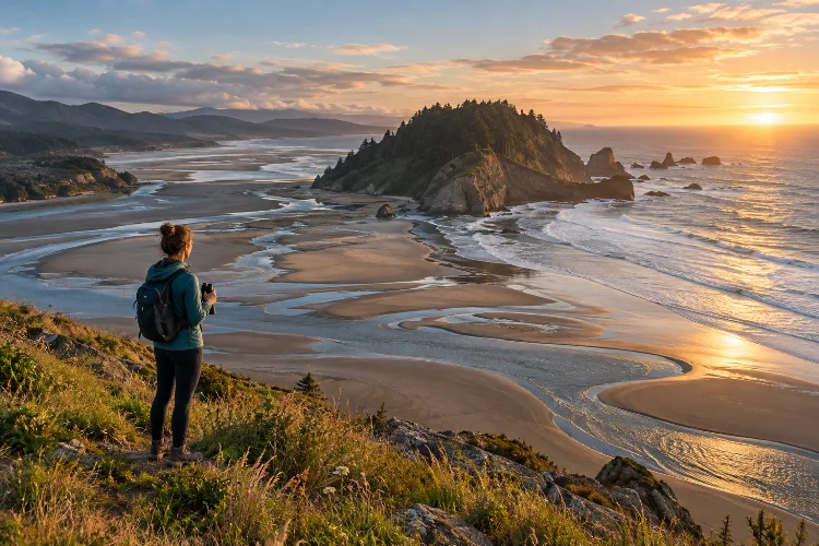
A beach that feels enormous in the morning can become a narrow strip of sand a few hours later. Rocky platforms disappear, tide pools refill, headlands become impossible to round, and walking routes that looked completely safe can suddenly end at deep water.
This constant transformation explains how tidal patterns influence access to coastal nature destinations. Unlike most inland attractions, coastlines do not offer exactly the same landscape throughout the day.
The gravitational influence of the Moon and Sun creates predictable rises and falls in sea level, but local geography, currents, wind, and weather can make the practical effects surprisingly complex.
NOAA describes tides as long-period waves that produce the regular rise and fall of ocean water along coastlines. The difference between high and low water is known as the tidal range.
For coastal hikers, photographers, wildlife watchers, kayakers, and casual visitors, understanding those patterns helps determine not only what can be seen, but also when particular places can be reached safely.
1. Low Tide Can Reveal Completely Different Landscapes
Low tide effectively expands many coastlines.
As the water retreats, broad stretches of sand, rock shelves, reefs, tidal flats, and pools may emerge. Places that are underwater for much of the day suddenly become accessible on foot.
This is particularly important for tide-pool exploration. Olympic National Park notes that its mid-tide zone becomes much more accessible around low tide, while the lowest intertidal areas may only appear during especially low tidal conditions.
Photographers and wildlife enthusiasts can benefit from the same window. Exposed rocks may attract shorebirds, while shallow pools reveal sea stars, anemones, crabs, and other organisms that remain hidden at higher water levels.
However, reaching farther into the intertidal zone also means visitors need to watch the clock. The route used to enter an exposed area may begin disappearing as the tide returns.
2. High Tide Can Cut Off Beaches and Walking Routes
The opposite happens as water rises.
Wide beaches narrow, rocky passages disappear, and waves begin reaching cliffs or vegetation that seemed far from the sea earlier in the day.
On rugged coastlines, this can create genuine access barriers. Olympic National Park warns that several coastal headlands are only passable at lower tides, while some cannot safely be rounded along the shore even during the lowest tide and require inland detours instead.
This is why coastal distance can be misleading.
A destination may be only three kilometers away geographically, yet reaching it could require waiting hours for lower water. In extreme cases, a particular tidal cycle can make sections inaccessible during daylight for several days.
Before walking into a narrowing beach corridor, identify whether there is higher ground or an alternate exit behind you.
3. Spring and Neap Tides Change the Size of the Access Window
Not every high tide or low tide reaches the same level.
When the Sun, Moon, and Earth are more closely aligned around new and full moons, tidal ranges generally become larger. These are known as spring tides. Around the first and third quarter phases, the range is usually smaller, producing neap tides.
NOAA explains that lunar phases also influence tidal currents, with stronger spring currents around new and full moons and weaker neap currents around quarter moons.
For visitors, this means two trips to exactly the same shoreline can look very different.
An especially low tide may expose a rock platform for much longer or reveal parts of a reef rarely accessible on foot. A higher spring tide, meanwhile, may push water significantly farther up a beach.
Understanding the wider tidal cycle is therefore more useful than simply asking whether low tide occurs at 10 a.m.
4. Tide Tables Help Turn Timing Into a Planning Tool
Because tides follow predictable astronomical cycles, travelers can check expected high and low water before visiting the coast.
NOAA tide tables provide predicted times and heights for thousands of coastal locations. Electronic predictions are available for daily, monthly, and longer planning periods, making them useful for both navigation and recreation.
The height matters as much as the time.
Suppose a rocky headland can normally be crossed only below a particular water level. Knowing that low tide happens at noon is not enough; you also need to know whether that low tide will actually fall below the required height.
Olympic National Park recommends using both a tide chart and a topographic map showing tidal restrictions when planning coastal wilderness routes.
Download or save this information before entering areas with unreliable mobile coverage rather than depending on an internet connection at the shoreline.
5. Weather Can Change What the Tide Table Suggests
Tidal predictions are powerful, but they are not perfect forecasts of actual coastal water levels.
NOAA explains that standard tide predictions primarily represent astronomical influences. Short-term factors such as wind, rainfall, freshwater runoff, and other weather conditions can cause observed water levels to differ from predictions.
That difference can matter enormously on a narrow beach.
Strong onshore winds or storms may push water higher and send larger waves farther inland. A passage that would normally be comfortable at a particular predicted tide could become unsafe.
Olympic National Park specifically warns that strong winds and offshore storms can elevate water levels enough to make normally passable coastal routes impassable.
Always combine tidal information with marine forecasts and current weather conditions. A printed number should never override what the ocean is visibly doing in front of you.
6. Tidal Currents Affect Estuaries, Inlets, and Kayaking Routes
Tides do more than move water vertically.
As water flows toward shore, bays, rivers, and estuaries during a rising tide, it creates a flood current. As the tide falls and water moves outward, it creates an ebb current.
These currents can significantly affect access by kayak, small boat, or even at shallow crossings.
A narrow inlet that looks calm at one moment may develop strong flow as the tide changes. NOAA notes that tidal current predictions help recreational users plan around periods of stronger flood and ebb currents.
This is why high or low tide time should not automatically be treated as the same thing as ideal current conditions.
For water-based trips, check tidal current information seperately from tide heights, especially around narrow channels, estuaries, harbor entrances, and tidal rivers.
7. Sea Caves and Rocky Headlands Require Extra Margin
Sea caves, arches, secluded coves, and rocky headlands are among the most attractive coastal features – and often among the most tide-sensitive.
A sea cave entrance may be easy to walk into during low water but become exposed to breaking waves as the tide rises. Similarly, a rocky corner between beaches may disappear long before the rest of the beach becomes flooded.
The key is not using the lowest predicted moment as your arrival target.
Instead, plan to enter and leave tide-sensitive areas with generous time on either side of low tide. Olympic National Park notes that the safer period for rounding certain restricted headlands is generally before the lowest tide rather than waiting until water has already begun rising significantly.
A good rule is to ask what happens if the route takes 30 minutes longer than expected.
If that small delay leaves no safe exit, the timing is probably too aggressive.
8. Tides Also Determine Where Coastal Camping Is Safe
Coastal camping requires a different understanding of space than inland camping.
A flat sandy area can look several meters away from the water during low tide but still fall below the night’s high-water line.
Olympic National Park advises wilderness travelers to camp above the high-tide water line.
Look for physical clues such as driftwood deposits, lines of seaweed, changes in sand texture, vegetation boundaries, and evidence of previous wave activity.
But do not depend on these signs alone. Storm waves and unusually high tides can reach beyond the obvious line.
Check the highest tide expected during your entire stay, not simply the tide present when you arrive. Setting up camp at 5 p.m. during falling water can give a very misleading impression of where the ocean will be at 2 a.m.
That small piece of preperation can prevent a very wet – and potentially dangerous – night.
9. Tidal Timing Can Transform a Coastal Itinerary
On complex shorelines, tides should influence the entire itinerary rather than being treated as a minor detail.
Imagine a route containing two tide-restricted headlands separated by four kilometers. The first becomes passable shortly before low tide, but the second requires similarly low water.
If difficult rocks slow your pace, you might clear the first obstacle but arrive at the second after the water has risen too far.
Olympic National Park specifically warns that successfully rounding one headland during a low tide does not mean the next headland will still be passable during the same tidal window.
Plan backwards from critical restrictions.
Determine when the safest passage is available, calculate conservative travel time, and then decide when you should leave the previous campsite or beach.
This approach makes tides part of route design rather than a problem discovered halfway through the day.
10. Wildlife Viewing Changes With the Tidal Cycle
Access is not only about whether humans can walk somewhere. Tides also influence when wildlife appears.
At low tide, exposed mudflats, rocks, and tide pools create feeding opportunities for shorebirds and reveal intertidal species. As water rises, marine animals move back into areas that were temporarily exposed.
The result is a constantly shifting habitat.
Visitors hoping to observe tide-pool organisms may prefer lower tides, while certain birdwatching locations can become more active as changing water concentrates feeding animals into smaller areas.
This also means visitors should tread carefully.
Avoid stepping on living organisms, moving animals from pools, or walking across fragile surfaces simply because low tide has made them accesible. The temporary absence of water does not mean the intertidal zone is empty or resilient to heavy foot traffic.
11. Never Treat Predicted Low Tide as a Guarantee of Safety
Perhaps the most important lesson is that low tide does not automatically mean safe access.
Large swell, slippery rocks, rogue waves, strong currents, poor visibility, storms, or blocked escape routes may still create dangerous conditions.
For example, Olympic National Park’s South Coast guidance warns visitors to check marine forecasts for hazardous swell and waves even when tidal timing is suitable. Some sections remain physically impassable during higher tides and require careful advance planning.
Always observe actual conditions before committing to a restricted area.
If waves are reaching farther inland than expected, or the weather has changed significantly from the forecast, modify the plan.
The ocean does not become harmless simply because an app says the tide is low.
Tides constantly reshape coastlines, changing which beaches, tide pools, headlands, flats, caves, and estuaries can be reached at different times of day. Understanding how tidal patterns influence access to coastal nature destinations therefore makes coastal travel both more rewarding and considerably safer.
Check the time and height of high and low tides, understand the wider spring-neap cycle, and combine predictions with weather, swell, current, and local terrain information. Give yourself extra time around restricted passages and never assume the route will remain open simply because it was accessible earlier.
Before your next coastal trip, make tidal research part of the itinerary rather than an afterthought. When you learn to travel with the rhythm of the ocean, the coast reveals far more of itself without forcing you into unnecessary risk.